[Updated February 2019]
The politics and political geography of New Hampshire have always fascinated me, since New Hampshire is not just the only swing state in New England, but it also home to the first-in-the-nation presidential primary every four years. This gives New Hampshire a level of nationwide importance mostly unmatched by other similarly-sized states.
Thus, it should come as no surprise that I have analyzed the results of many New Hampshire elections in-depth, and have mapped a large variety of elections in the Granite State.
Several examples are below:


I have made maps of the following elections in New Hampshire:
- 2008, 2012, and 2016 presidential elections, and comparisons between them
- 2008, 2010, 2014, and 2016 U.S. Senate elections
- 2012 – 2018 gubernatorial elections, and comparisons between them
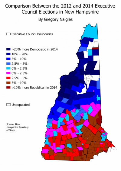
- 2012 – 2018 Executive Council elections, and comparisons between them
- 2012 – 2018 state senate elections, and comparisons between them
- 2016 Presidential primary elections, both Democratic and Republican
- 2018 state House of Representatives gains and losses
